

The Location of Things
GEOSPATIAL
Geospatial information is data with a location element. It is also about the science of “where” and has the potential to underpin major advancements in society.
The Geospatial Spectrum
Mapping and Remote Sensing
Satellites and sensors collect raw geospatial data about the Earth's surface, providing content for geospatial products and services.

The Geospatial Spectrum
Mapping and Remote Sensing
Satellites and sensors collect raw geospatial data about the Earth's surface, providing content for geospatial products and services.
The Geospatial Spectrum
Mapping and Remote Sensing
Satellites and sensors collect raw geospatial data about the Earth's surface, providing content for geospatial products and services.
The Geospatial Spectrum
Data and Database Management
Geospatial databases provide a systematic way to create, retrieve, update, and manage geospatial data.

The Geospatial Spectrum
Data and Database Management
Geospatial databases provide a systematic way to create, retrieve, update, and manage geospatial data.
The Geospatial Spectrum
Data and Database Management
Geospatial databases provide a systematic way to create, retrieve, update, and manage geospatial data.
The Geospatial Spectrum
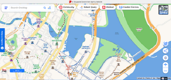
Systems and Applications
Systems and applications link back-end database processes and front-end map functions to deliver geospatial services.
The Geospatial Spectrum
Systems and Applications
Systems and applications link back-end database processes and front-end map functions to deliver geospatial services.
The Geospatial Spectrum
Systems and Applications
Systems and applications link back-end database processes and front-end map functions to deliver geospatial services.
The Geospatial Spectrum
Modelling and Analysis
Geospatial modelling and analytics tools allow users to discover insights from geospatial data for enhanced decision making.

The Geospatial Spectrum
Modelling and Analysis
Geospatial modelling and analytics tools allow users to discover insights from geospatial data for enhanced decision making.
The Geospatial Spectrum
Modelling and Analysis
Geospatial modelling and analytics tools allow users to discover insights from geospatial data for enhanced decision making.